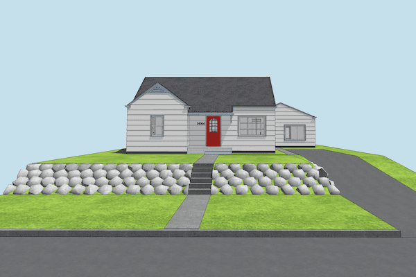
In the video below I look at a number of site models I’ve built over the past few years and discuss a variety of techniques. After watching the video, if you want to experiment with some of these methods, I highly recommend you download the Shoegnome Open Template as pretty much everything I share started off as a Favorite from the template. If you see me press some buttons on the keyboard and are annoyed that you don’t have that shortcut or you are wondering where the button/toolbar I use is, download my Work Environment.
To help you build even better sites in Archicad, check out these older posts:
Archicad Site Models: Images on Meshes
An Introduction to Modeling Rocks and Boulders in Archicad
Adding Contours to a Mesh in Archicad (I actually cover this in the video above)
If you want all the latest Shoegnome Open Template news, sign up for the mailing list
If you aren’t using the current version of Archicad, you can download older versions of my template. If you use my template, I highly recommend you use my Work Environment as well. The two work together well and the Work Environment is designed to reinforce the best practices of the template. You can download my Work Environment here.
Subscribe to my blog to read more about the tricky world of being an Architect in the 21st century. Follow Shoegnome on Facebook, Instagram, and Youtube.

11 thoughts on “Site Models in Archicad”
Jared – What a lovely potpourri of tips and tricks.
You opened my eyes to some very creative and useful applications of Archicad’s tools.
I love the little side comments from your daughter!
– Eric Bobrow
Thanks Jared,
A lot of tips useful for a seasoned ArchiCad user as myself, as everyone tends to use AC in different ways and workflows. It’s always fun to watch another archicad user make use of the tools in dofferent ways 🙂
Take care and greetings from Finland,
Dominicus
Thanks. Glad you liked the video. Giving people a chance to watch another Archicad user work is at the core of why I do the videos the way I do.
….and to add; the terrain and road intersection method of visualizing roads and pathways is superb as you can make changes along the way and don’t have to redo the whole road every time. I used to do it by using slabs and boolean operations to first cut away the underside of the slab against the mesh and then convert it to a morph. Then lowering the morph by a friction and boolean it against the mesh and using the morphs material on the mesh to get all the roads visible with a different material and a bit lower than the rest.
Your method is sooo much better at least when doing studies in the beginning.
Thanks/ Dominicus
Good stuff! I live & work in mountain geography, so my site modeling has required “creative modeling solutions” from day 1. Thanks for sharing your site modeling tricks!
Thanks Billy!
Excellent video Jared! Incredibly informative and thanks for sharing!
Do you use the 3d terrain in your sections? Or do you use a graphic fill? I ask because I run into issues modeling the terrain and then doing SEOs when I want to clean up conflicts with the new foundation walls, slab, etc. The issues really arise out of which renovation filter layer you have it on. When I show a 3d view of the exiting it then has the SEOs for the new.
Sometimes I create another terrain copy that is on the existing Reno filter. But, it seems odd to create both. However, I can’t find a great workaround. Sometimes, I find myself using combination of 3d modeling and fills in my sections. It’s a bit clunky and I’m curious if you found a cleaner way.
Good question. And something I should have addressed in the video. I have two meshes: the original terrain and then the terrain post-remodel (same for new construction as there’s an original mesh and an alternated mesh that relates to the building). Often the original terrain just lives in the existing conditions model and I bring it back into the main model if i ever need it. This relates to how many copies of a file I have-basically one for every day because you never know when you want to go back in time…and multiple files is easier and faster to manage than digging into a backup like Time Machine (which I also have). I typically don’t do any SEO on the original terrain because I don’t need it to look perfect in sections.
I try to use the mesh in sections and elevations, but every so often it’s easier to hide it or mask it with a Fill to match. That only happens when the terrain is really complex and is too busy in elevation/creates weird ups and downs at the section cut line. If I hide the mesh, it’s very late in the process (near permit submission) as I don’t care if things are a little weird graphically prior to that.
Oh…and awesome video editing! 🙂
🙂 I’ll share your compliments with Madeleine!
Great tips, I use many similar techniques picked up over the years.
Wow, that’s my boulder wall object, now in the USA, amazing, didn’t even know I had donated it to the wider community.